
Ashokan High Point: Kanape Brook PA
| Quick Look | |||||
|---|---|---|---|---|---|
| Difficulty | Round trip | Total climb | Location | Internet Maps | |
| 8.1 mi. (loop) | 2200 ft. | N41.92450 W74.28800 | AllTrails | ||
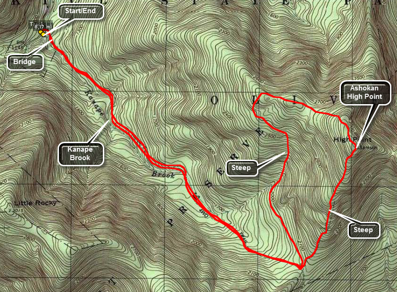
Park at the Kanape Brook PA trailhead on the Peekamoose Road. Walk across the road and toward the Ashokan to pick up the trail. The first 2.7 miles is a rather gentle uphill walk. Much of the first part of the trail parallels Kanape Brook which can be heard as you walk along the trail. Several small bridges and culverts cross tributaries which increase the volume of the brook. The trail hear is a wide road typical of logging or quarrying roads that run throughout the Catskills. At the 2.7 mile mark make a pronounced left. The trail now narrows to a footpath but is marked and well-worn. You are immediately faced with a choice! The trail straight ahead continues upward fro about 1 mile to the Ashokan High Point. This trail gains about 1000 feet over the mile and there are several steep areas. Most of these areas have stone steps which make the climb easier. The trail to the left is longer but generally easier to climb. This 2.5 mile trail meanders up to the High Point. Once at the High Point itself you have a beautiful view of the mountains and valleys directly to the east. Depending on the foliage cover, you may be able to see a hint of the reservoir a little farther north or to the left as you gaze from the lookout. A little farther to the north and west the trail opens into several fields and can become hard to follow. Some visitors have built a fire circle surrounded by stone chairs. Walking to the north and east side of the field gives you a spectacular view of the Ashokan Reservoir. The view is NOT clear and is blocked by trees making the best viewing times when the leaves are not on the trees. Turning your gaze a little more to the north and west reveals the Burrough's Range with the unmistakable outline of Wittenberg, Cornell, and Slide Mountains. After taking in the view, you can descend the same way you came up or loop around. The entire loop is about 8 miles.
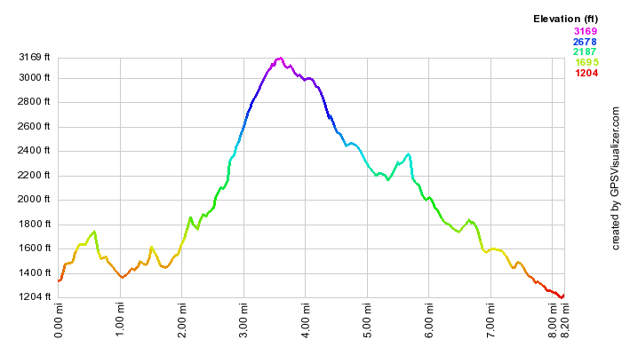 (The image at the left shows the profile of the loop hiking route. Remember that all vertical profiles are
relative!)
(The image at the left shows the profile of the loop hiking route. Remember that all vertical profiles are
relative!)
| Quick Look | ||||
|---|---|---|---|---|
| Difficulty | Round trip | Total climb | Location | Internet Maps |
| 2200 ft. | N41.92450 W74.28800 | AllTrails | ||
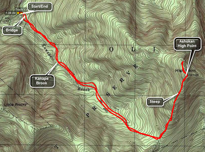 An alternative route to the one shown above is an out and back hike. The loop adds a small distance to the hike but it has several ups and downs along the way. The loop trail has few points of interest. The out and back allows a quick descent of the steeper sections for those who don't mind this sort of thing. Both routes get you to the same place and get you back to your car.
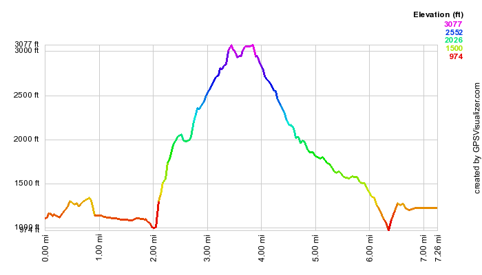 (The image at the left shows the profile of the out and back hiking route. Remember that all vertical profiles are
relative!)
(The image at the left shows the profile of the out and back hiking route. Remember that all vertical profiles are
relative!)