
Giant Ledge
| Quick Look | ||||
|---|---|---|---|---|
| Difficulty | Round trip | Total climb | Internet Maps | |
| 3.1 mi. | 980 ft. | AllTrails | ||
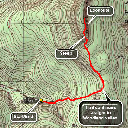 Park at the trailhead on the Frost Valley Road just after Winisook Lake on the hairpin turn. Find
the yellow-blazed Phoenecia-East Branch trail and hike .65 miles to the blue-blazed Giant Ledge -
Panther Mountain Trail. This ascent is rather gradual with a few short, steep areas thrown in. After
about .75 miles, you reach Giant Ledge. Here there are a series of ledges that look to the east and
offer a view of Wittenberg and Slide. The return hike simply reverses the trip out. The total distance
is just over 3 miles making it perfect to get into shape.
Park at the trailhead on the Frost Valley Road just after Winisook Lake on the hairpin turn. Find
the yellow-blazed Phoenecia-East Branch trail and hike .65 miles to the blue-blazed Giant Ledge -
Panther Mountain Trail. This ascent is rather gradual with a few short, steep areas thrown in. After
about .75 miles, you reach Giant Ledge. Here there are a series of ledges that look to the east and
offer a view of Wittenberg and Slide. The return hike simply reverses the trip out. The total distance
is just over 3 miles making it perfect to get into shape.
(The map above shows the parking area and the out and back hiking route.)

(The image at the left shows the profile of the hike. This profile only reflects the hike out to Giant Ledge. The hike back is the same only in reverse; descending rather than ascending.)
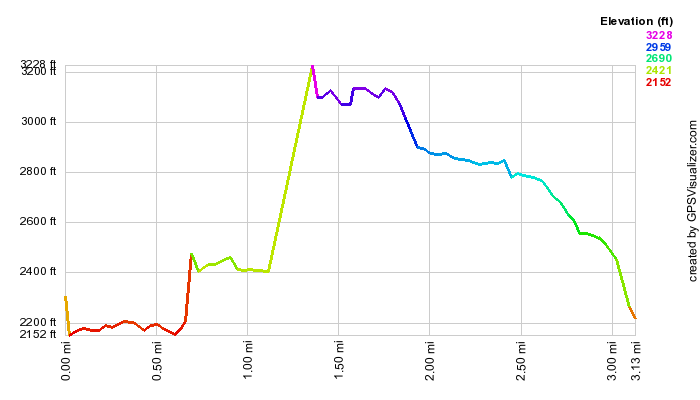
(The image at the left shows the profile of the hike. This profile only reflects the hike out to Giant Ledge. The hike back is the same only in reverse; descending rather than ascending.)