
Hamburg High Point
| Quick Look | |||||
|---|---|---|---|---|---|
| Difficulty | Round trip | Total climb | Location | Elevation | Internet Maps |
| 2.63 mi | 604 ft | N41.1524 W74.5139 Sussex | 1495 ft | AllTrails | |
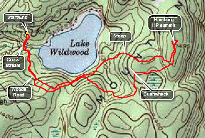 From Hamburg, NJ take Route 23 South. Turn left or east on Rt 517 Rudetown Road. Watch for Sand Pond Road on the right. Turn right and drive to the end near the gate that is clearly posted as PRIVATE PROPERTY. Park in the pulloff at the end of Sand Pond Road. This hike is mostly a bushwhack with a few paths and woods roads thrown in. Head south into the woods and cross the Lake Wildwood outlet. Watch for PRIVATE PROPERTY signs and stay clear. Head southeast and then northeast around the lake using roads and paths as you see fit. On the way out I continued northeast for until about .85 miles and then began to head east and UP to the summit ridge. I ran in to some steep spots with a lot of blowdown and thick brush. Once on top I headed north to tag the high point. I followed the same route to the south end of the ridge but then headed southwest to try to avoid the thick stuff from earlier. I found some roads which took me first south and then northwest back to my original route and I reversed course from there.
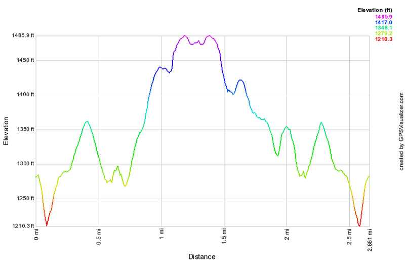 (The image at the left shows the profile of the hike. Remember that all vertical profiles are
relative!)
(The image at the left shows the profile of the hike. Remember that all vertical profiles are
relative!)