
Whitehall Hill
| Quick Look | |||||
|---|---|---|---|---|---|
| Difficulty | Round trip | Total climb | Location | Elevation | Internet Maps |
| 3.15 mi | 848 ft | N40.9603 W74.7443 Sussex | 1081 ft | AllTrails | |
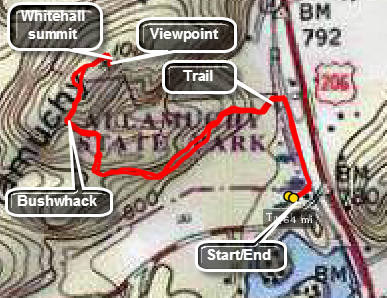 Park at pulloff on North Shore Road just off Route 206 on the right side of the road. Walk on the road toward Rt 206 and turn left on the multi-use trail that parallels the road. At .2 miles a trail will appear on the left. Turn on this trail and walk to .55 miles it will be clear that the trail is headed passed Whitehall. Turn right or north toward the peak and climb up a little. You may find another woods road at this point. Continue to work your way north which will require a final bushwhack up the south side of Whitehall. Watch for POSTED signs as the actual summit is on private property. If you are lucky, as I was, the owners of the property may be around and grant you permission to walk to the high point. There is a nice lookout with a picnic table near the highest elevation. Follow your same route back to the car.
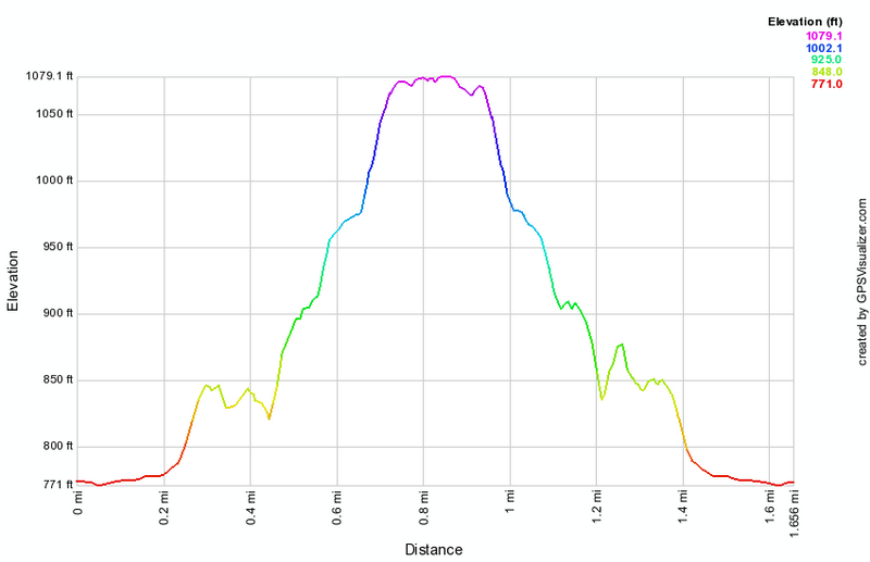 (The image at the left shows the profile of the hike. Remember that all vertical profiles are relative!)