
The map below was created by Google Maps. Click on the GPS track to see the length of the hike. Use the zoom controls in the upper left corner to ZOOM IN and to ZOOM OUT on the map. Use the ARROW keys to move the map or LEFT CLICK and hold to drag the map around. The choices in the upper right corner change control the type of map. MAP shows streets and roads. SAT is an aerial satellite image of the area. TER shows a 3D simulated terrain with some contour lines.
View Larger Map
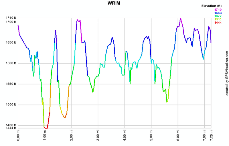
The diagram below is a profile of the GPS track of the hike on the Google Map above.
The map below shows the GPS track of the hike with some interesting points labeled. Moving the mouse pointer over the map will show a picture from that point of interest. Clicking on the map will link to a picture gallery from a hike of the area.