
| Pick a Scary 19 Peak: |
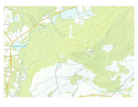
Bald Mountain
Bald Mountain near Stamford is located on private property but the owner, Doug Murphy, allows hikers free access. It is typically approached from the west from Archibald Park. It has also been approached as a bushwhack from the south via Blackberry Road. There are great lookouts all around the mountain, especially near the old ski lift of the former Scotch Valley Ski Area.
Clicking on the map below will allow you to download a full page, printable PDF map.
| Quick Look - from Archibald Field | ||||
|---|---|---|---|---|
| Difficulty | Round trip | Total climb | Internet Map | Parking |
| 4.5 mi. | 953 ft. | AllTrails | N42.4227 W74.6204 | |
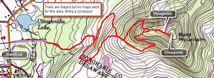
From the junction of Routes 23 and 10 in Stamford, drive .9 miles north on Route 10 to Archibald Field on the right. Park in the first parking area. To begin the hike walk to the gravel road just south of the parking area and turn left heading east. Soon you will cross a stream on a footbridge where the fun really begins. There are many trails in this area and all are blazed but there are no maps which makes the blazes useless. All is not lost as you want to hike "east and up". There are several different routes to the top with some being longer and others shorter. It seems that all these routes converge on one final trail that approaches the summit from the west. Just before the summit there is a nice lookout on the left which has excellent views to the north. As you reach the top of Bald Mountain you will see some old buildings and the remains of a chair lift. At one time this mountain was home to the Deer Run Ski Area which is no longer in operation. Explore the summit which as at least a 180 degree view before returning to the parking area. It may interest you to return by a slightly different route than the one you used to ascend.
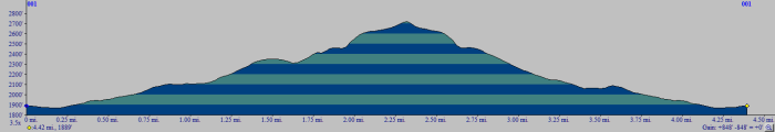 (The image at the left shows the profile of the hike. Remember that all vertical profiles are relative!)