
| Pick a Scary 19 Peak: |
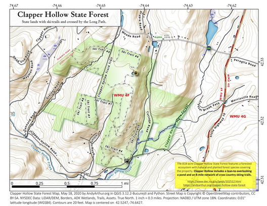
Clapper Hollow
This area is an "add-on" for the winter patch. It is worth hiking even if that patch is not your goal".Clapper Hollow is one of the few areas in the state system that is "dedicated" to cross country skiing. This does not mean you can't hike or snowshoe there. The system is over 2000' in elevation yet there is a very minimal gain in elevation. The highest point being on Ski Trail 6. This system is required for the Winter Rocker for the Scary 19 patch. You must ski, snowshoe, or winter hike to the lean-to. You may drop one of other 19 required peaks or do all 19 plus Clapper Hollow to make 20 adventures for the winter.
Clicking on the map below will allow you to download a full page, printable PDF map. (Courtesy of Andy Arthur)
| Quick Look | ||||
|---|---|---|---|---|
| Difficulty | Round trip | Total climb | Internet Map | Parking |
| 4.8 mi. | 500 ft. | AllTrails | N42.5131 W74.6438 | |
The trail in this area are not always well marked and there are many logging roads and informal paths. I suggest you print out the map. This description is based on an actual hike with corrections for the extra explorations that went nowhere.
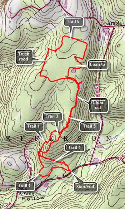
Drive north on Route 10 from Jefferson in Schoharie County for a little more than 2 miles. Turn left on Moxley St (Route 15). Make an immediate right on Clapper Hollow Road and drive a little less than 1 mile to the parking area on the right. Leave the parking area walking straight ahead on Trail 4. Walk for about .4 miles and then turn right or north on Trail 1. Walk mostly northeast on Trail 1 to .8 miles where it intersects with Trail 5. Turn left and walk uphill to 1.5 miles passing through a clear cut area. At the junction, turn right on Trail 6 and follow it to the lean-to and pond at 1.7 miles. Take some time to relax at the pond and then continue to follow Trail 6 as it makes a loop above the pond. The trail will zig-zag and then make a rectangular loop. At about 2.5 miles be careful to watch for the point where Trail 6 turns off the logging road and heads southwest briefly and then west to a road. Turn right on the road and walk down to the Clapper Hollow Truck Road. Turn left and walk along the road to 3 miles. Turn left on Trail 5 as the truck road comes to a dead end a little further on. Walk east on Trail 5 to 3.25 miles when you will have come back to the junction with Trail 6. Turn right and continue to 4 miles. Continue straight ahead on an informal path to 4.25 miles where you will again pickup Trail 1. Continue straight ahead to do a short loop. Continue to follow this trail back out to the parking area.
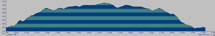 (The image shows the profile of the hike. Remember that all vertical profiles are relative!)