
| Pick a Scary 19 Peak: |
Lutheranville HP
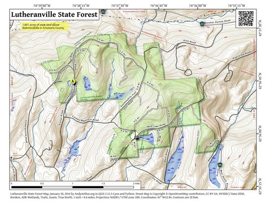
Lutheranville HP is located in the Lutheranville State Forest. It can be accessed from the DEC parking area on Mud Lake Road and from several other approaches. Lutheranville State Forest offers a lake, many ponds, and a northwest bump with a Geodetic Marker stamped Woodbeck.
Clicking on the map below will allow you to download a full page, printable PDF map. (Courtesy of Andy Arthur)
| Quick Look - from Moot Rd and Spruce Lake Rd | ||||
|---|---|---|---|---|
| Difficulty | Round trip | Total climb | Internet Maps | Parking |
| 3.9 mi. | 460 ft. | AllTrails | N42.5884 W74.6107 | |
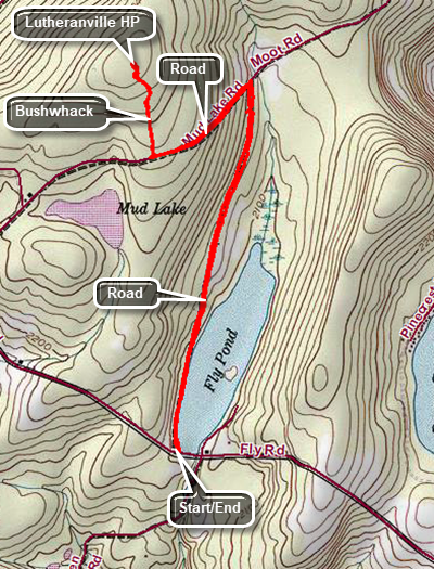
Drive to Summit, NY on Route 10 north of Jefferson. Turn west on Charlotte Vallety Road. At the top of the hill, turn right on Spruce Lake Road. Drive 1.2 miles to Fly Lake at the intersection of Spruce Lake Road and Moot Road. Park off the roads. Walk north on Moot Road along the west shore of Fly Lake. After 1.2 miles, turn left on Mud Lake Road and start to walk uphill for .4 miles to a clear cut on the right. There is also a snowmobile trail that may be a better approach in some seasons. Walk through or along the side of the clear cut for about .2 miles walking north and uphill. Enter the forest where you will find a mix of dense brush, clearings, and open forest. Walk another .2 miles or so to the highest point you can find and check it with your GPS unit if you like. Wander around some if you wish and then return in the same general way you came.
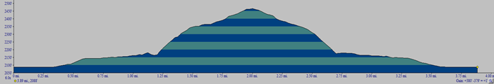 (The image shows the profile of the hike. Remember that all vertical profiles are relative!)