
Bearfort Lookout
| Quick Look | |||||
|---|---|---|---|---|---|
| Difficulty | Round trip | Total climb | Location | Elevation | Internet Maps |
| 4.15 mi | 700 ft | N41.1043 W74.4175 Passaic | 1340 ft | AllTrails | |
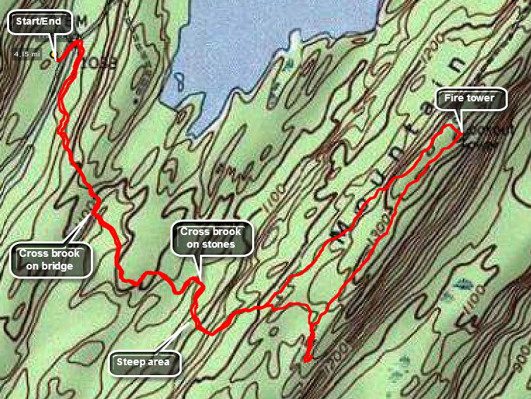 Park at parking area P4 on Clinton Road in the Pequannock Watershed Area. This area is owned by the City of Newark Water Supply and they require a parking permit. The area is patrolled so go to their headquarters on Echo Lake Road and buy a yearly permit. Walk back out to the road, turn left, walk across the road bridge, cross the road and walk into the woods on the trail. The trail ascend through an evergreen forest until it tops out at .5 miles and then descend to cross a brook on a bridge. Continue on the trail over the next bump and cross another brook on stepping stones at 1.0 miles. The trail begins to ascend to the ridge and at 1.3 miles you may go straight ahead or turn left. Turn left and continue to ascend to the ridge to 2.0 miles when the fire tower should come into view. Climb the tower for the best views around before continuing your hike. You may retrace your steps or walk southwest on the ridge and slightly down for the next .5 miles. At 2.5 miles take the cutoff trail to the right and descend off the ridge back to the trail junction from earlier. Follow your original route back to the car.
 (The image at the left shows the profile of the hike. Remember that all vertical profiles are relative!)