
Guerin Benchmark
| Quick Look | |||||
|---|---|---|---|---|---|
| Difficulty | Round trip | Total climb | Location | Elevation | Internet Maps |
| .91 mi | 190 ft | N40.8404 W74.5776 Morris | 1130 ft | AllTrails | |
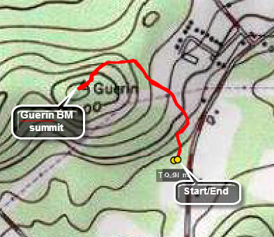 Take Route 46 south from I80. Where RT 46 and Rt 10 split bear right on Rt 10. Turn right on Millbrook Ave. and park in the parking lot across from Freedom Park on Millbrook Road. Walk through the gate at the north end of the lot and start out on the wide, groomed trail. Turn right at the FIRST TURN and head up to the power line right of way. Cross the right of way to continue on the trail. At about .3 miles watch for a stone lined path on the left that leads to the high point. Avoid going straight on the trail. Walk another .15 miles to the high point and then revere your route to get back to the car.
(The map at the right shows the parking area and the hiking route in a clockwise direction.)
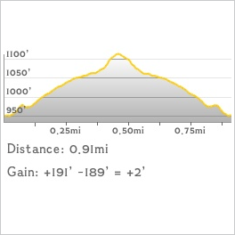 (The image at the left shows the profile of the hike. Remember that all vertical profiles are
relative!)
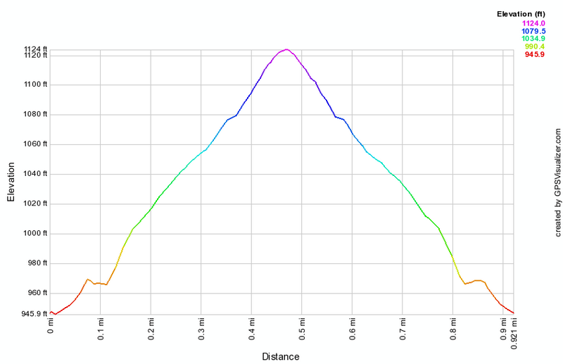
(The image at the left shows the profile of the hike. Remember that all vertical profiles are
relative!)
 (The image at the left shows the profile of the hike. Remember that all vertical profiles are
relative!)
(The image at the left shows the profile of the hike. Remember that all vertical profiles are
relative!)