
Hasenclever Hill
| Quick Look | |||||
|---|---|---|---|---|---|
| Difficulty | Round trip | Total climb | Location | Elevation | Internet Maps |
| 2.63 mi | 604 ft | N41.1579 W74.2685 Passaic | 1065 ft | AllTrails | |
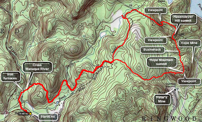 Park at the Long Pond Ironworks in Hewitt, NJ. Follow the paths to the right of the main office through the "village" to the area of the iron furnaces. Turn right to take the bridge over the Wanaque River onto the Sterling Ridge Trail. At the first trail junction, take the yellow blazed Hasenclever Trail to the right and follow it until about 3.6 miles at the base of Hope Mountain. The trail turns right to skirt the mountain. Start your bushwhack my continuing straight ahead and up Hope Mountain using the many paths and ATV trails as you like. There are some nice vies on the way up but the summit has no views. From the summit continue to bushwhack down heading, steeply at times, until you cross a stream and a woods road. Stay on a northwest bearing and pass by a LARGE glacial erratic as you start to ascend to the summit. After ascending for .7 miles and a few steep spots you will be at the highest part of the peak in New Jersey. Con tune to walk along the edge of the cliffs into New York where an outstanding viewpoint called Black Rick is located. Views of Big Beach and the Ramapos as well as the valleys are all below you. Many people follow the sate line markers on a bushwhack to Big Beach. At some point descend from the ridge and head south or southwest to intercept your route from earlier. This area has a maze of roads and paths, some of which may prove useful. Once you find your route out reverse it to the parking area.
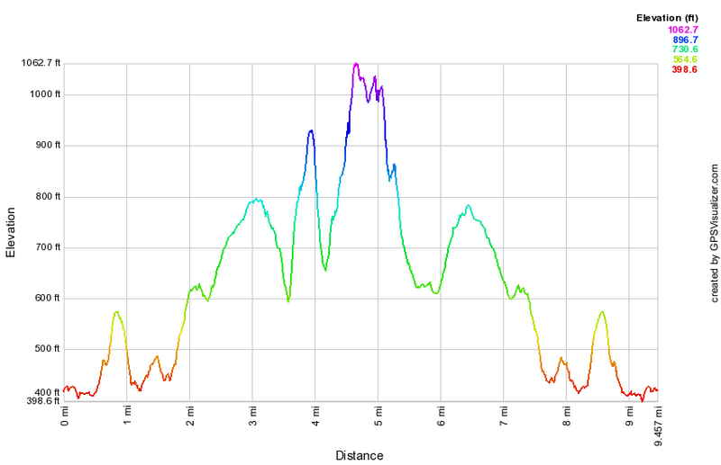 (The image at the left shows the profile of the hike. Remember that all vertical profiles are relative!)