
East Mary Smith Hill
| Quick Look - East Mary Smith Hill | |||||
|---|---|---|---|---|---|
| Difficulty | Round trip | Total climb | Location | Internet Maps | |
| 5.0 mi. | 1260 ft | N42.0328 W74.8198 | AllTrails | ||
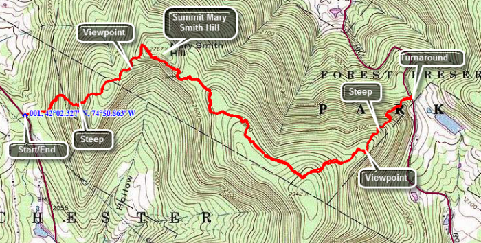 Head north on the Beaverkill Road for about 5.2 miles and turn left on Campsite Road. At the fork in the road bear right and cross the Beaverkill Covered Bridge. At the intersection with Berry Brook Road turn right and drive another 3.7 miles to the parking area on the right. The first .6 miles of the trail are pretty steep gaining a little over 500 feet. The surface has some loose rocks which can slip underfoot. After climbing to the top of the first, unnamed hill you will descend a little before starting up Mary Smith Hill. At .9 miles the trail makes a sharp right turn swinging from ENE to SE and then ascending Mary Smith Hill. You will walk through several areas where you pass between or climb over large rocks. Just before the top of Mary Smith Hill there is a lookout which has a limited view to the south. Continue on the main trail little farther along the trail to the next hill which is East Mary Smith Hill. The highest point is a little south of the trail so bushwhack south to the highest point. When you have reached your goal, retrace your route back to your car.
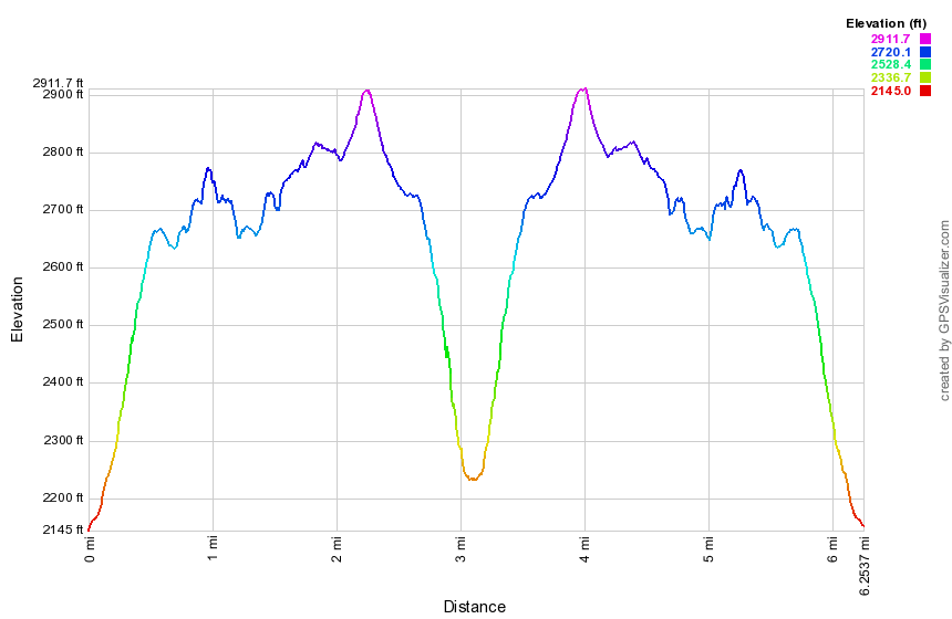
(The image at the left shows the profile of the hike.)