
Samson Mountain
| Quick Look - Samson Mountain | |||||
|---|---|---|---|---|---|
| Difficulty | Round trip | Total climb | Location | Internet Maps | |
| 6.0 mi. | 2100 ft. | N42.2291 W74.4388 | AllTrails | ||
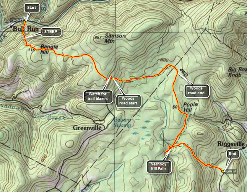 Turn onto Route 52A near the TriValley School. Stay on the road until the hamlet of Sundown where the road turns left. Bear to the left on Peekamoose Rd. and continue on the road until parking areas begin to show up on the left. Watch for a brown and yellow sign on the right for the Long Path toward Cherrytown Road. There is a small parking area opposite the start of this trail. The next parking area on the left is the Upper Peekamoose Parking Area and is much larger. Of course, you may also reach this area by turning onto Peekamoose Road off Route 28A, the road that runs along the south side of the Ashokan Reservoir. Once you are on the trail there is a climb of over 1100 feet in the first mile to the top of Bangle Hill. As you walk up the trail look over your left shoulder for a view of Peekamoose Mountain. There is a small set of ledges near the top of Bangle hill but they are VERY small. From the top of Bangle Hill the trail turns east and descends for some distance until ascending to the highest point just south of Samson Mountain after about 2.4 miles. From this point bushwhack northeast to the summit of Samson Mountain. After reaching your goal, retrace your route to the car.
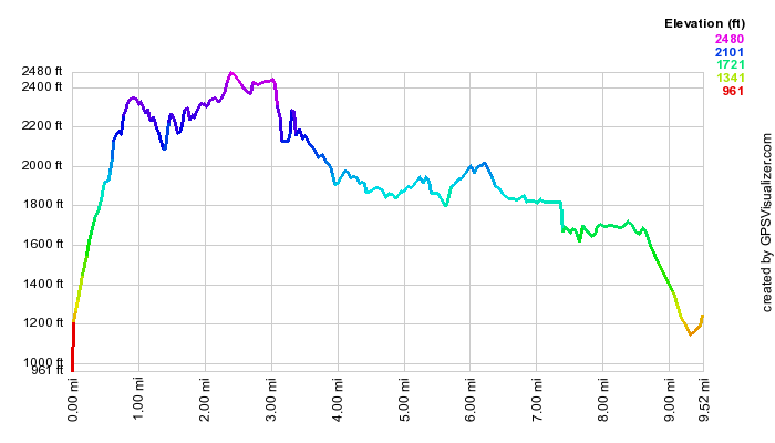 (The image at the left shows the profile of the hike. Remember that all vertical profiles are relative!)